ZCZC MIATWOAT ALL
TTAA00 KNHC DDHHMM
Tropical Weather Outlook
NWS National Hurricane Center Miami FL
800 AM EDT Mon Aug 3 2020
For the North Atlantic...Caribbean Sea and the Gulf of Mexico:
The National Hurricane Center is issuing advisories on Tropical
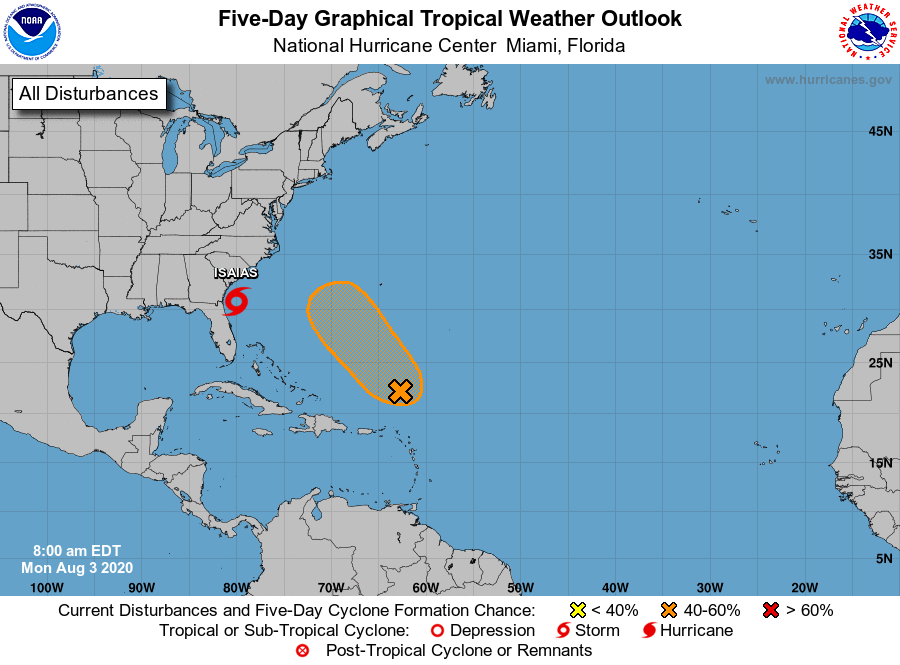
Storm Isaias, located just offshore of northeast Florida.
1. A surface trough of low pressure, located a few hundred miles north
of the northern Leeward Islands, is producing disorganized showers
and thunderstorms. Marginal environmental conditions could allow
for some slow development of this system during the next several
days, with a tropical depression possibly forming later this week.
This system is forecast to move northwestward at about 15 mph over
the southwestern Atlantic today and on Tuesday, and then stall
several hundred miles southwest of Bermuda by the middle to latter
part of the week.
* Formation chance through 48 hours...medium...40 percent.
* Formation chance through 5 days...medium...60 percent.
Forecaster Roberts