ZCZC MIATWOAT ALL
TTAA00 KNHC DDHHMM
Tropical Weather Outlook
NWS National Hurricane Center Miami FL
800 PM EDT Sat Aug 1 2020
For the North Atlantic...Caribbean Sea and the Gulf of Mexico:
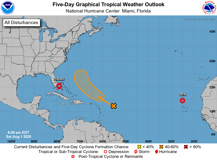
The National Hurricane Center is issuing advisories on Tropical
Storm Isaias, located between Andros Island in the central Bahamas
and southeastern Florida, and on Tropical Depression Ten, located
over the far eastern Atlantic to the north of the Cabo Verde
Islands.
1. Showers and thunderstorms associated with a tropical wave located a
a few hundred miles east of the Leeward Islands have slowly become
better organized throughout the day. Although the disturbance does
not appear to be very well defined at the surface at this time,
environmental conditions are forecast to be conducive for some
additional development for the next few days, and a tropical
depression could form early next week. This system is forecast to
turn northwestward and then northward over the western Atlantic,
passing north of the Leeward Islands on Monday and Tuesday.
* Formation chance through 48 hours...low...30 percent.
* Formation chance through 5 days...medium...60 percent.
Forecaster Zelinsky