ZCZC MIATWOAT ALL
TTAA00 KNHC DDHHMM
Tropical Weather Outlook
NWS National Hurricane Center Miami FL
200 PM EDT Mon Jul 27 2020
For the North Atlantic...Caribbean Sea and the Gulf of Mexico:
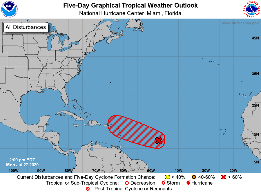
1. Shower activity associated with a broad area of low pressure located
about 1000 miles east of the Windward Islands has changed little in
organization since this morning. Environmental conditions are
expected to become somewhat more favorable for development during
the next few days and a tropical depression or tropical storm is
likely to form during that time frame. The system is forecast to
move westward to west-northwestward at 15 to 20 mph and it could
bring heavy rain to portions of the Leeward Islands by late
Wednesday, regardless of development. Interests in the Lesser
Antilles should continue to monitor the progress of this system.
* Formation chance through 48 hours...high...70 percent.
* Formation chance through 5 days...high...80 percent.
Forecaster Zelinsky