ZCZC MIATWOAT ALL
TTAA00 KNHC DDHHMM
Tropical Weather Outlook
NWS National Hurricane Center Miami FL
800 AM EDT Mon Jul 27 2020
For the North Atlantic...Caribbean Sea and the Gulf of Mexico:
The Weather Prediction Center has issued the last advisory on the
remnants of Hanna, located inland over northern Mexico.
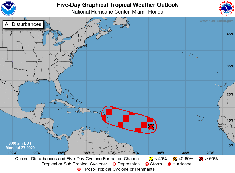
1. Shower activity associated with a broad area of low pressure located
a little more than 1000 miles east of the Windward Islands has
become a little less organized since last night. However,
environmental conditions are still expected to become more favorable
for development in a day or two and a tropical depression or
tropical storm will likely form within the next couple of days. The
system is forecast to move westward to west-northwestward at 15 to
20 mph and could begin to affect portions of the Lesser Antilles on
Wednesday or Wednesday night. Interests on those islands should
continue to monitor the progress of this system.
* Formation chance through 48 hours...high...80 percent.
* Formation chance through 5 days...high...90 percent.
Forecaster Zelinsky