ZCZC MIATWOAT ALL
TTAA00 KNHC DDHHMM
Tropical Weather Outlook
NWS National Hurricane Center Miami FL
800 PM EDT Wed Jul 22 2020
For the North Atlantic...Caribbean Sea and the Gulf of Mexico:
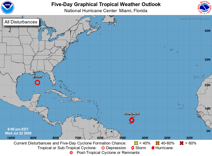
The National Hurricane Center is issuing advisories on Tropical
Storm Gonzalo, located over the central tropical Atlantic.
1. Data from the Air Force Hurricane Hunters and surface observations
indicate that an area of low pressure over the central Gulf of
Mexico is gradually becoming better defined. However, the
accompanying shower and thunderstorm activity is still poorly
organized. Environmental conditions appear conducive for slow
development of this system, and a tropical depression is likely to
form during the next day or so as it moves west-northwestward at
about 10 mph. Interests in the western Gulf of Mexico should
monitor the progress of this system, as watches or warnings could be
required for portions of the coasts of Texas and Louisiana tonight
or on Thursday.
* Formation chance through 48 hours...high...80 percent.
* Formation chance through 5 days...high...90 percent.
Forecaster Cangialosi