ZCZC MIATWOAT ALL
TTAA00 KNHC DDHHMM
Special Tropical Weather Outlook
NWS National Hurricane Center Miami FL
1200 AM EDT Sat Jul 4 2020
For the North Atlantic...Caribbean Sea and the Gulf of Mexico:
Special Tropical Weather Outlook issued to discuss potential
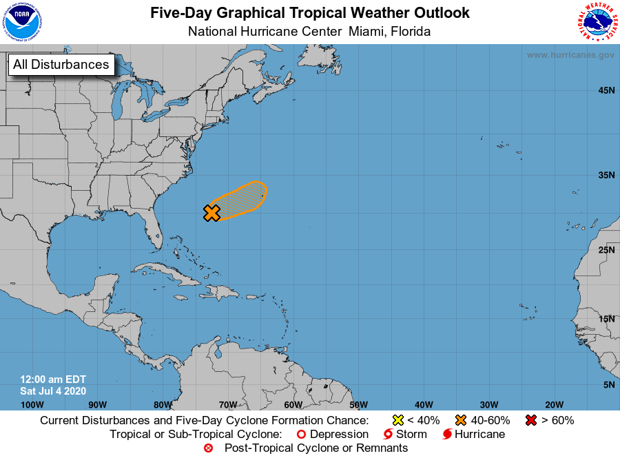
tropical development of low pressure system southwest of Bermuda.
1. An area of thunderstorms has persisted near the center of a small
low pressure system located more than 300 miles southwest of
Bermuda. Recent satellite-derived surface wind data indicate that
winds have increased and that the circulation has become better
defined. If this recent development trend continues, then a tropical
depression could form overnight or early Saturday while the system
moves eastward at about 15 mph. By Sunday night, however,
environmental conditions are expected to become unfavorable for
significant development to occur. Interests in Bermuda should
monitor the progress of this system.
* Formation chance through 48 hours...medium...40 percent.
* Formation chance through 5 days...medium...40 percent.
Forecaster Blake/Stewart