ZCZC MIATWOAT ALL
TTAA00 KNHC DDHHMM
Tropical Weather Outlook
NWS National Hurricane Center Miami FL
700 AM EST Tue Nov 19 2019
For the North Atlantic...Caribbean Sea and the Gulf of Mexico:
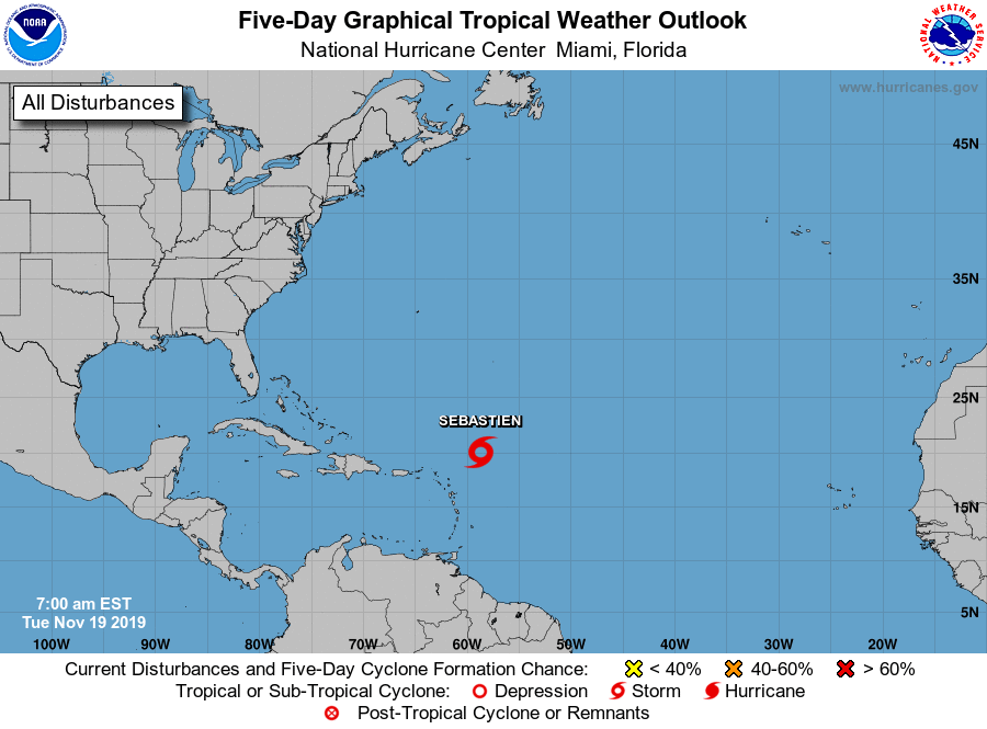
1. A broad area of low pressure located about 250 miles northeast of
the northern Leeward Islands is gradually becoming better organized
and the associated shower and thunderstorm activity has been
developing closer to the center since yesterday. If this trend
continues, then a tropical or subtropical depression or storm could
form in the next day or so while the system moves northwestward and
then northward over the open Atlantic. The low is forecast to
interact with a frontal system by midweek and further development is
unlikely after that time. For more information, see High Seas
Forecasts issued by the National Weather Service.
* Formation chance through 48 hours...high...80 percent.
* Formation chance through 5 days...high...80 percent.
High Seas Forecasts issued by the National Weather Service can be
found under AWIPS header NFDHSFAT1, WMO header FZNT01 KWBC, and
online at ocean.weather.gov/shtml/NFDHSFAT1.php
Forecaster Latto