ZCZC MIATWOAT ALL
TTAA00 KNHC DDHHMM
Tropical Weather Outlook
NWS National Hurricane Center Miami FL
800 AM EDT Wed Oct 23 2019
For the North Atlantic...Caribbean Sea and the Gulf of Mexico:
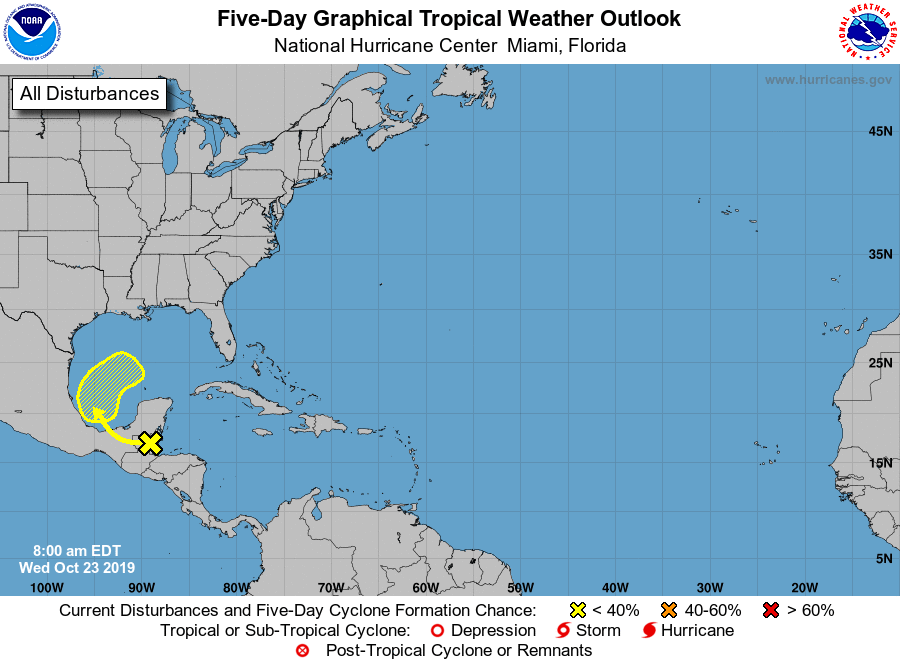
1. A tropical wave is producing disorganized showers and thunderstorms
over the Yucatan Peninsula, Belize, and the adjacent waters of the
northwestern Caribbean Sea. This disturbance is forecast to move
west-northwestward and emerge over the Bay of Campeche on Thursday,
and then move northward and northeastward into the southwestern and
central Gulf of Mexico on Friday and Saturday. Some development
will be possible by late Friday and Saturday before the system
likely becomes absorbed by a cold front on Sunday.
* Formation chance through 48 hours...low...near 0 percent.
* Formation chance through 5 days...low...30 percent.
Forecaster Stewart