ZCZC MIATWOAT ALL
TTAA00 KNHC DDHHMM
Tropical Weather Outlook
NWS National Hurricane Center Miami FL
800 PM EDT Mon Sep 23 2019
For the North Atlantic...Caribbean Sea and the Gulf of Mexico:
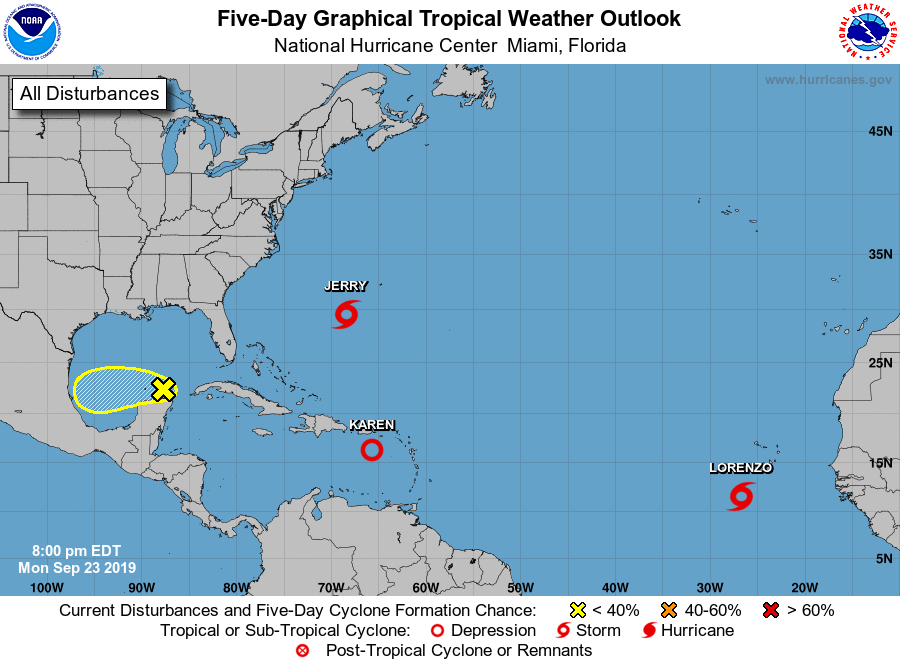
The National Hurricane Center is issuing advisories on Tropical
Storm Jerry, located a few hundred miles southwest of Bermuda, on
recently downgraded Tropical Depression Karen, located over the
eastern Caribbean Sea, and on Tropical Storm Lorenzo located over
the far eastern Atlantic.
1. A weak area of low pressure located near the north coast of the
Yucatan peninsula continues to produce disorganized showers and
thunderstorms. Some gradual development of the disturbance is
possible while it moves slowly westward across the southwestern Gulf
of Mexico during the next several days before it reaches the
northeast coast of Mexico late Friday or Saturday.
* Formation chance through 48 hours...low...10 percent.
* Formation chance through 5 days...low...20 percent.
Forecaster Cangialosi