ZCZC MIATWOAT ALL
TTAA00 KNHC DDHHMM
Tropical Weather Outlook
NWS National Hurricane Center Miami FL
800 PM EDT Wed Aug 21 2019
For the North Atlantic...Caribbean Sea and the Gulf of Mexico:
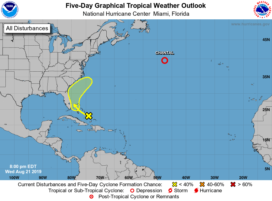
The National Hurricane Center is issuing advisories on Tropical
Storm Chantal, located several hundred miles south-southeast of
Cape Race, Newfoundland.
1. An area of disorganized showers and thunderstorms, associated with a
trough of low pressure, extends over the Southeast and Central
Bahamas. Some slow development of this system is possible by late
this week as it drifts west-northwestward toward the Florida
peninsula. The system is expected to move generally northward near
the southeast coast of the United States and adjacent waters by
the end of the weekend.
* Formation chance through 48 hours...low...near 0 percent.
* Formation chance through 5 days...low...20 percent.
Public Advisories on Tropical Storm Chantal are issued under WMO
header WTNT34 KNHC and under AWIPS header MIATCPAT4.
Forecast/Advisories on Tropical Storm Chantal are issued under WMO
header WTNT24 KNHC and under AWIPS header MIATCMAT4.
Forecaster Roberts