ZCZC MIATWOAT ALL
TTAA00 KNHC DDHHMM
Tropical Weather Outlook
NWS National Hurricane Center Miami FL
800 PM EDT Fri Aug 16 2019
For the North Atlantic...Caribbean Sea and the Gulf of Mexico:
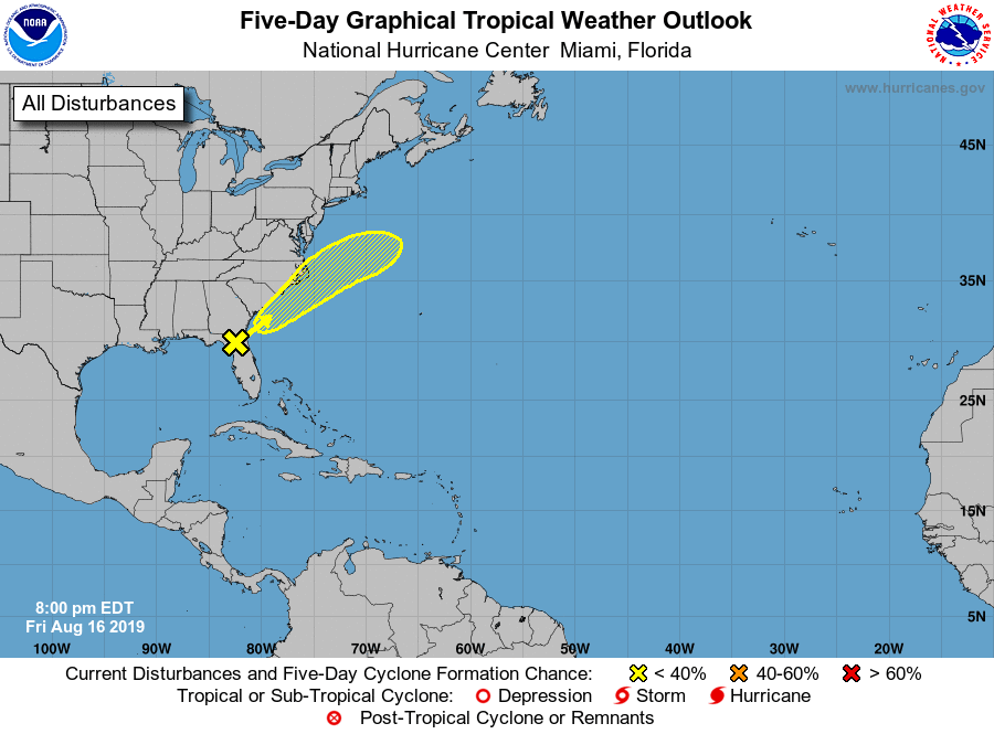
1. A surface trough of low pressure is producing a large but
disorganized area of showers and thunderstorms over the northeastern
Gulf of Mexico and across northeastern Florida. Any tropical
development of this system is expected to be slow to occur over the
next few days while it moves northeastward at 5 to 10 mph near the
coasts of Georgia, South and North Carolina. Regardless of
development, the disturbance is forecast to produce heavy
rainfall along with a threat of flash flooding in that region.
Please see information from your local National Weather Service
office or the Weather Prediction Center's Excessive Rainfall Outlook
for more information.
* Formation chance through 48 hours...low...10 percent.
* Formation chance through 5 days...low...20 percent.
Forecaster Blake/Hagen