ZCZC MIATWOAT ALL
TTAA00 KNHC DDHHMM
Tropical Weather Outlook
NWS National Hurricane Center Miami FL
200 PM EDT Fri Aug 2 2019
For the North Atlantic...Caribbean Sea and the Gulf of Mexico:
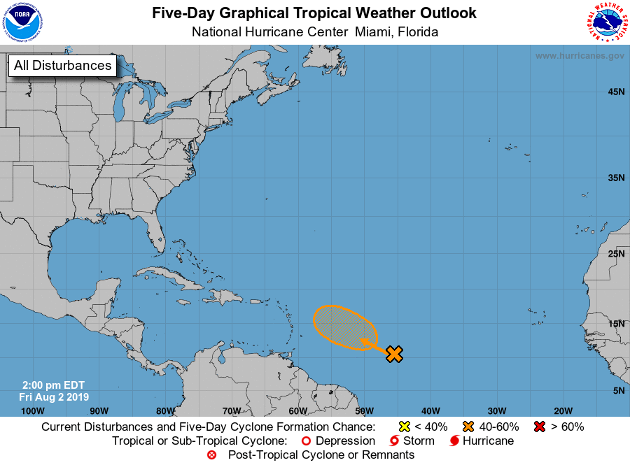
1. An elongated area of low pressure located over the central tropical
Atlantic Ocean several hundred miles southeast of the Lesser
Antilles is generating widespread disorganized showers. Some slow
development of this system is still possible, and a tropical
depression could form well east of the Leeward Islands by early next
week while the low moves west-northwestward at 10 to 15 mph.
Upper-level winds are forecast to become less conducive for
development as the system approaches the Leeward Islands Tuesday and
Wednesday.
* Formation chance through 48 hours...low...20 percent.
* Formation chance through 5 days...medium...40 percent.
Forecaster Zelinsky/Ramos