ZCZC MIATWOAT ALL
TTAA00 KNHC DDHHMM
Tropical Weather Outlook
NWS National Hurricane Center Miami FL
800 AM EDT Mon Jul 29 2019
For the North Atlantic...Caribbean Sea and the Gulf of Mexico:
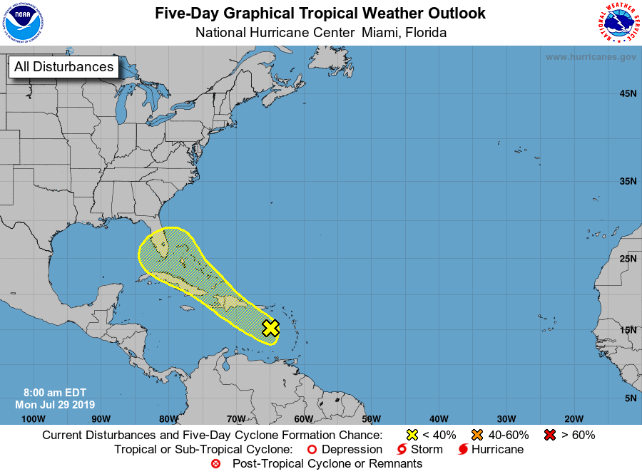
1. Shower activity associated with a tropical wave over the eastern
Caribbean Sea is disorganized and limited. This system is expected
to move west-northwestward across the Caribbean Sea and the Greater
Antilles during the next few days bringing locally heavy rainfall
and possibly some flooding across portions of these islands. Little
or no development of this disturbance is anticipated during the
next couple of days. However, conditions could be a little more
conducive for tropical cyclone formation when the system reaches the
the Florida Straits or the Bahamas over the weekend.
* Formation chance through 48 hours...low...10 percent.
* Formation chance through 5 days...low...20 percent.
Forecaster Avila