Skip Navigation Links
NOAA NOAA United States Department of Commerce

NHC Graphical Outlook Archive


« Earliest Available         ‹ Earlier         Later ›         Latest Available »
GIS Shapefiles
Central Pacific Eastern North Pacific Atlantic

View 2-Day Graphical Tropical Weather Outlook
Click for Eastern North Pacific Click for Eastern North Pacific

Tropical Weather Outlook Text

ZCZC MIATWOAT ALL
TTAA00 KNHC DDHHMM

Tropical Weather Outlook
NWS National Hurricane Center Miami FL
800 PM EDT Wed Jul 24 2019

For the North Atlantic...Caribbean Sea and the Gulf of Mexico:

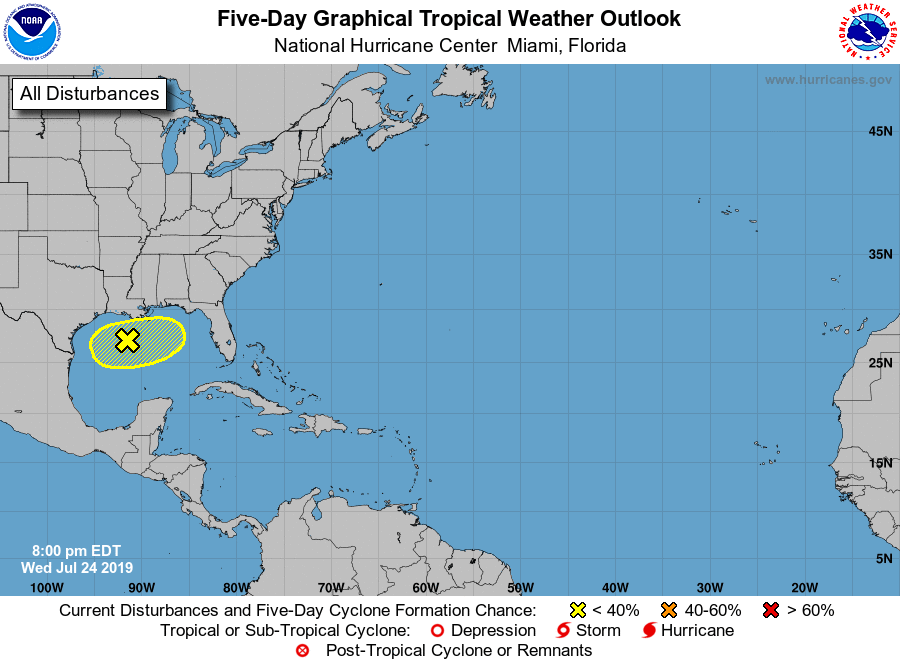
1. Disorganized showers and thunderstorms stretching across portions
of the northern and central Gulf of Mexico are associated with a
frontal boundary and a weak area of low pressure.  Significant
development of this system appears unlikely due to dry air and
unfavorable upper-level winds while the disturbance drifts northward
during the next couple of days.
* Formation chance through 48 hours...low...10 percent.
* Formation chance through 5 days...low...10 percent.

Forecaster Cangialosi


List of Atlantic Outlooks (May 2023 - present)
List of East Pacific Outlooks (May 2023 - present)
List of Central Pacific Outlooks (May 2023 - present)
List of Atlantic Outlooks (July 2014 - April 2023)
List of East Pacific Outlooks (July 2014 - April 2023)
List of Central Pacific Outlooks (June 2019 - April 2023)
List of Atlantic Outlooks (June 2009 - June 2014)
List of East Pacific Outlooks (June 2009 - June 2014)