ZCZC MIATWOAT ALL
TTAA00 KNHC DDHHMM
Special Tropical Weather Outlook
NWS National Hurricane Center Miami FL
220 PM EDT Fri May 31 2019
For the North Atlantic...Caribbean Sea and the Gulf of Mexico:
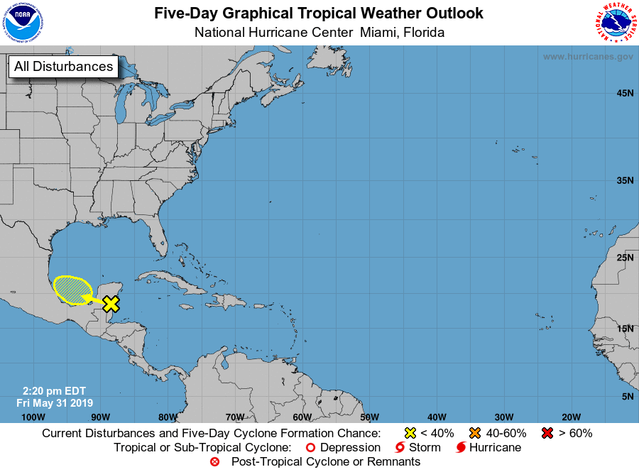
1. A broad area of low pressure accompanied by cloudiness and showers
centered over the Yucatan Peninsula is forecast to move westward
over the southern Bay of Campeche during the weekend. Some gradual
development of this system is possible through early next week as
long as it remains over water. Regardless of development, the
disturbance will likely produce heavy rainfall over portions of
southern Mexico during the next few days. Regular issuance of the
Tropical Weather Outlook will begin at 2 AM EDT tonight with the
beginning of the Atlantic hurricane season.
* Formation chance through 48 hours...low...20 percent.
* Formation chance through 5 days...low...30 percent.
Forecaster Avila/Zelinsky