ZCZC MIATWOAT ALL
TTAA00 KNHC DDHHMM
Special Tropical Weather Outlook
NWS National Hurricane Center Miami FL
950 AM EDT Thu May 2 2019
For the North Atlantic...Caribbean Sea and the Gulf of Mexico:
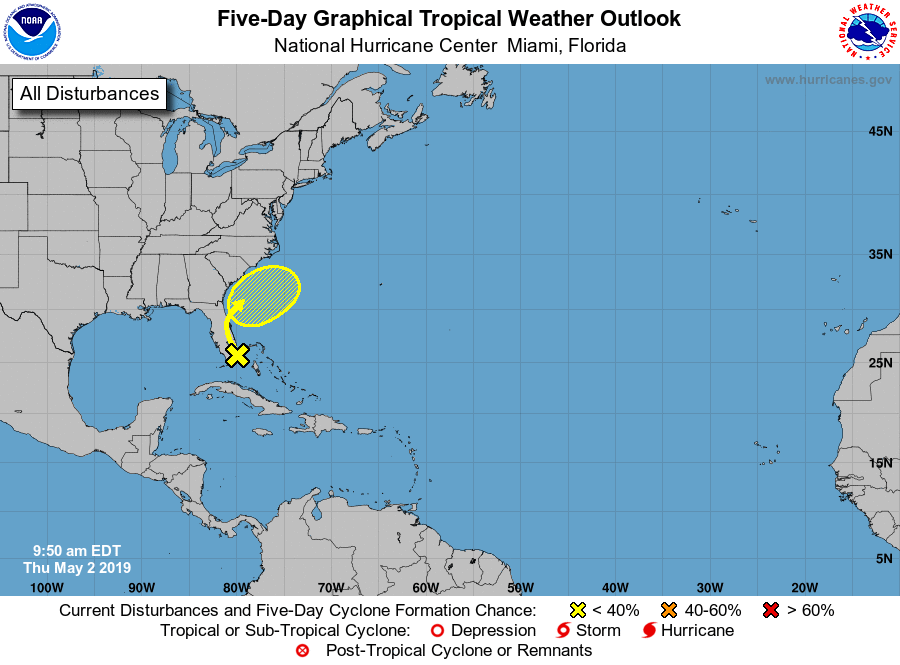
1. A trough of low pressure that extends from South Florida
northeastward over the western Atlantic for a few hundred miles
is producing disorganized shower and thunderstorm activity.
Environmental conditions are not expected to be conducive for
significant development of this system while it moves northwestward,
and then northward over the Florida peninsula and near the southeast
United States coast during the next day or so. This system is
forecast to merge with a frontal system later this weekend.
Regardless of development, locally heavy rains are possible over
portions of the Bahamas and the Florida peninsula during the next
day or so. The next Special Tropical Weather Outlook will be issued
by 10 AM EDT Friday, or sooner if conditions warrant.
* Formation chance through 48 hours...low...10 percent.
* Formation chance through 5 days...low...10 percent.
Forecaster Brown