ZCZC MIATWOAT ALL
TTAA00 KNHC DDHHMM
Tropical Weather Outlook
NWS National Hurricane Center Miami FL
700 PM EST Mon Nov 12 2018
For the North Atlantic...Caribbean Sea and the Gulf of Mexico:
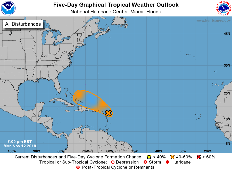
1. A tropical wave that is interacting with an upper-level trough
continues to produce a large area of disturbed weather that
extends from near the Leeward Islands northeastward over the
tropical Atlantic for several hundred miles. This system has
not become any better organized over the past 24 hours, and
environmental conditions may not become as conducive as
previously anticipated. Therefore, the potential for this system
to become a tropical or subtropical cyclone has decreased.
Regardless of development, this system is forecast to bring locally
heavy rainfall to portions of the Leeward Islands, the Virgin
Islands, and Puerto Rico over the next few days.
* Formation chance through 48 hours...medium...40 percent.
* Formation chance through 5 days...medium...60 percent.
Forecaster Brown