ZCZC MIATWOAT ALL
TTAA00 KNHC DDHHMM
Tropical Weather Outlook
NWS National Hurricane Center Miami FL
800 PM EDT Sun Sep 23 2018
For the North Atlantic...Caribbean Sea and the Gulf of Mexico:
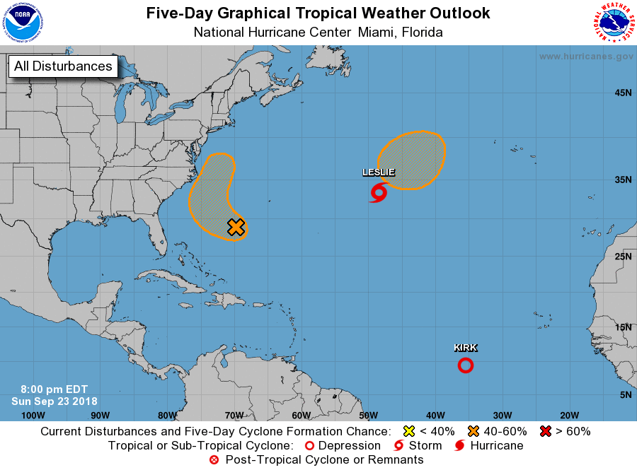
The National Hurricane Center is issuing advisories on Tropical
Storm Kirk, located several hundred miles southwest of the Cabo
Verde Islands, and on Subtropical Storm Leslie located more than
1000 miles west of the Azores.
1. A broad area of low pressure located about 375 miles southwest of
Bermuda continues to produce limited shower and thunderstorm
activity. Environmental conditions are forecast to become a little
more conducive for development during the next couple of days while
the system moves slowly west-northwestward to northwestward over
the southwestern Atlantic. The low is forecast to turn northward
by Tuesday night, and pass near the southeastern United States coast
on Wednesday. After that time, upper-level winds are forecast to
become less favorable while the low begins to move northeastward,
away from the east coast of the United States.
* Formation chance through 48 hours...low...30 percent.
* Formation chance through 5 days...medium...40 percent.
2. A non-tropical low pressure system is expected to form north of
Subtropical Storm Leslie along a central Atlantic cold front by
Wednesday. Leslie and the non-tropical low are forecast to merge
over the central Atlantic where conditions appear conducive
for the resulting low to acquire subtropical or tropical
characteristics by the latter part of this week.
* Formation chance through 48 hours...low...near 0 percent.
* Formation chance through 5 days...medium...40 percent.
Public Advisories on Leslie are issued under WMO header WTNT33
KNHC and under AWIPS header MIATCPAT3. Forecast/Advisories on
Leslie are issued under WMO header WTNT23 KNHC and under AWIPS
header MIATCMAT3.
Forecaster Brown