ZCZC MIATWOAT ALL
TTAA00 KNHC DDHHMM
Tropical Weather Outlook
NWS National Hurricane Center Miami FL
200 AM EDT Thu Aug 30 2018
For the North Atlantic...Caribbean Sea and the Gulf of Mexico:
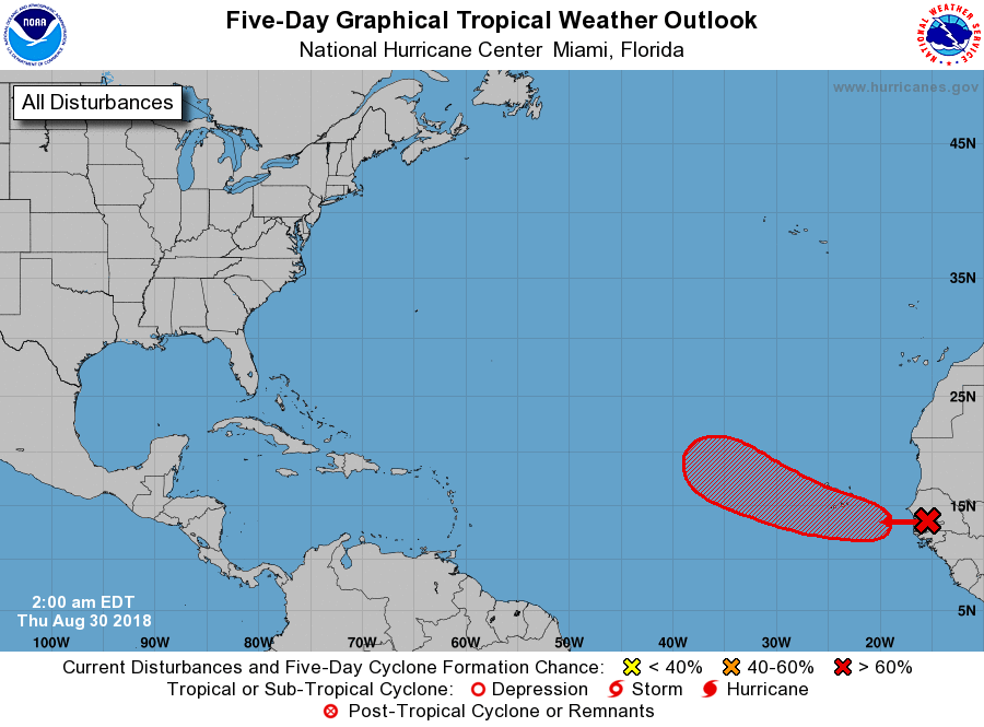
1. Disorganized showers and thunderstorms moving off the coast of
Senegal are associated with a strong tropical wave and broad area
of low pressure. A more well-defined low pressure system is
forecast to form between Senegal and the Cabo Verde Islands later
today after the tropical wave moves offshore over the far eastern
Atlantic Ocean, and the low is likely to become a tropical
depression by the weekend while moving westward or west-
northwestward at about 15 mph. This system is expected to bring
heavy rains and gusty winds to the Cabo Verde Islands on Friday and
Saturday, and interests on the islands should monitor the progress
of this disturbance.
* Formation chance through 48 hours...medium...60 percent.
* Formation chance through 5 days...high...80 percent.
Forecaster Berg