ZCZC MIATWOAT ALL
TTAA00 KNHC DDHHMM
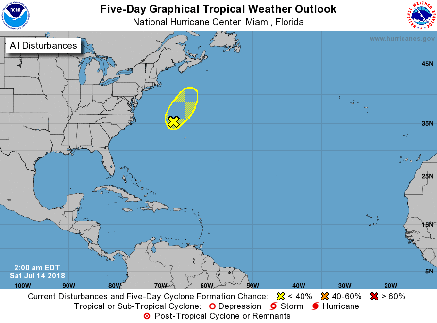
Tropical Weather Outlook
NWS National Hurricane Center Miami FL
200 AM EDT Sat Jul 14 2018
For the North Atlantic...Caribbean Sea and the Gulf of Mexico:
1. An area of low pressure, associated with the remnants of Beryl, is
located about 240 miles northwest of Bermuda. This system has not
shown much change in organization over the past several hours,
and upper-level winds are forecast to be only marginally conducive
for additional development while the low moves north-northeastward
at about 10 mph. By Sunday, the system should reach colder waters
north of the Gulf Stream, where development is unlikely.
* Formation chance through 48 hours...low...30 percent.
* Formation chance through 5 days...low...30 percent.
Forecaster Pasch