ZCZC MIATWOAT ALL
TTAA00 KNHC DDHHMM
Tropical Weather Outlook
NWS National Hurricane Center Miami FL
800 PM EDT Mon Oct 16 2017
For the North Atlantic...Caribbean Sea and the Gulf of Mexico:
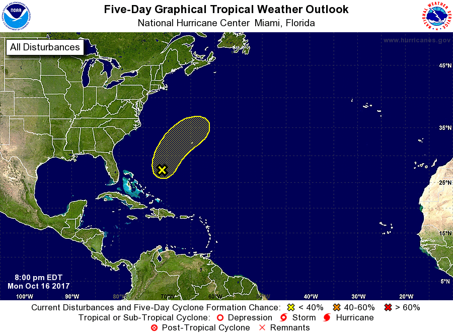
1. Broad low pressure centered about 500 miles southwest of Bermuda
continues to produce an elongated area of disorganized showers and
thunderstorms which extends from Puerto Rico northward over the
western Atlantic Ocean. The low's circulation is not well defined,
and significant tropical development appears unlikely during the
next day or so due to strong upper-level winds. The disturbance is
forecast to move generally northeastward, merging with a frontal
system over the western Atlantic by Tuesday night.
* Formation chance through 48 hours...low...30 percent.
* Formation chance through 5 days...low...30 percent.
Forecaster Berg