ZCZC MIATWOAT ALL
TTAA00 KNHC DDHHMM
Tropical Weather Outlook
NWS National Hurricane Center Miami FL
200 PM EDT Mon Oct 16 2017
For the North Atlantic...Caribbean Sea and the Gulf of Mexico:
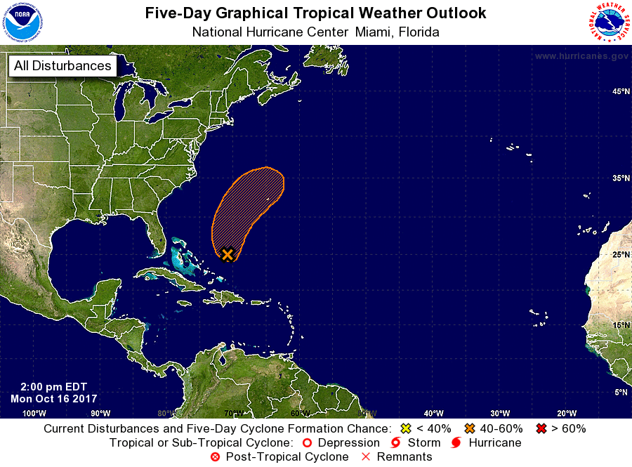
1. Showers and thunderstorms associated with a broad area of low
pressure located a couple of hundred miles east of the Central
Bahamas have changed little in organization since this morning.
Satellite imagery indicates that the circulation is elongated and
not well defined. Upper-level winds are forecast to remain
marginally conducive for some development during the next day or so
while the system moves generally northward and then northeastward.
Conditions are expected to become unfavorable for further
development by Wednesday when the disturbance merges with a frontal
system over the western Atlantic.
* Formation chance through 48 hours...medium...40 percent.
* Formation chance through 5 days...medium...40 percent.
Forecaster Pasch