ZCZC MIATWOAT ALL
TTAA00 KNHC DDHHMM
Tropical Weather Outlook
NWS National Hurricane Center Miami FL
800 PM EDT Sat Oct 7 2017
For the North Atlantic...Caribbean Sea and the Gulf of Mexico:
The National Hurricane Center is issuing advisories on Hurricane
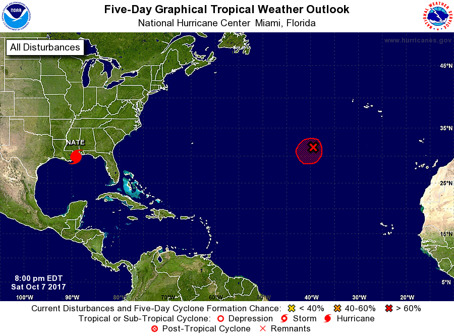
Nate, located near the mouth of the Mississippi River.
1. A stationary low pressure system located about 700 miles southwest
of the Azores is producing limited shower and thunderstorm activity.
Environmental conditions are expected to be conducive for the
development of a tropical or subtropical cyclone for the next day or
so while the system drifts toward the southwest or south. After
that time, strong upper-level winds are expected to limit further
development.
* Formation chance through 48 hours...high...70 percent.
* Formation chance through 5 days...high...70 percent.
Forecaster Zelinsky