ZCZC MIATWOAT ALL
TTAA00 KNHC DDHHMM
Tropical Weather Outlook
NWS National Hurricane Center Miami FL
200 AM EDT Mon Oct 2 2017
For the North Atlantic...Caribbean Sea and the Gulf of Mexico:
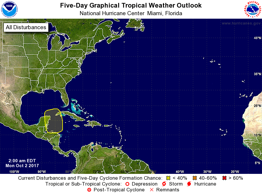
1. An elongated surface trough of low pressure interacting with an
upper-level low is producing widespread cloudiness and scattered
showers across much of the northwestern Caribbean Sea, the Yucatan
peninsula, Belize, Honduras, and Guatemala. Although surface
pressures are unusually low across the region, strong upper-level
winds and the large disturbance's proximity to land should prevent
any significant organization for the next few days. However,
environmental conditions could become a little more favorable for
the development of a low pressure system by the end of the week
across the northwestern Caribbean Sea or the southern Gulf of Mexico
while the system moves little or drifts northward.
* Formation chance through 48 hours...low...near 0 percent.
* Formation chance through 5 days...low...20 percent.
Forecaster Stewart