ZCZC MIATWOAT ALL
TTAA00 KNHC DDHHMM
Tropical Weather Outlook
NWS National Hurricane Center Miami FL
200 PM EDT Fri Sep 22 2017
For the North Atlantic...Caribbean Sea and the Gulf of Mexico:
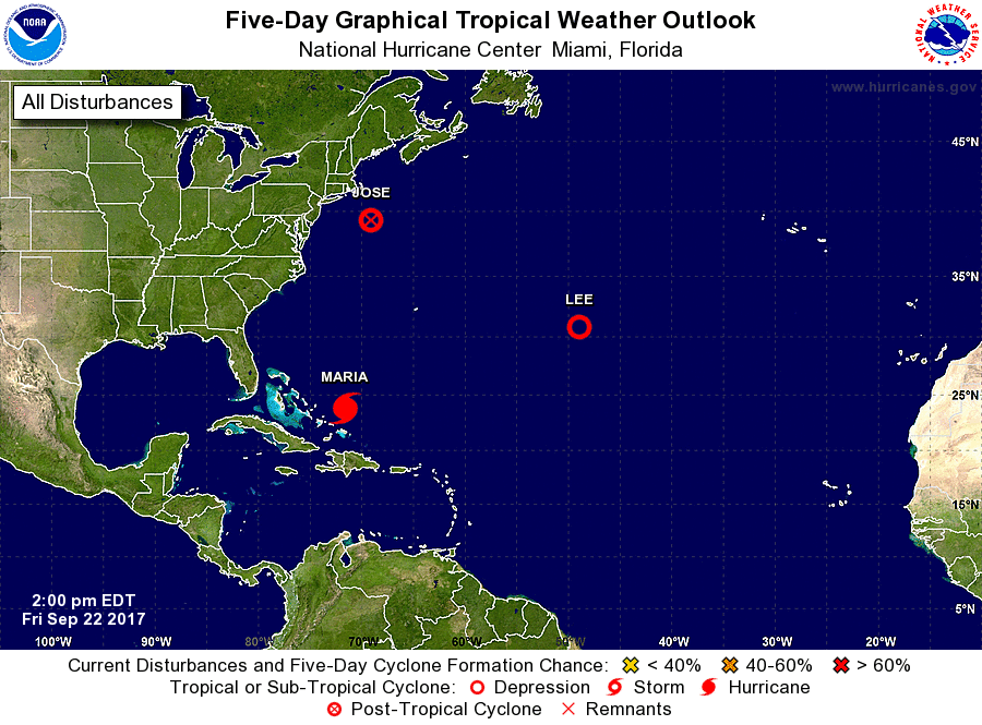
The National Hurricane Center is issuing advisories on Post-Tropical
Cyclone Jose, located a little over a hundred miles south-southeast
of Nantucket, Massachusetts, and on Hurricane Maria, located just to
the north of Grand Turk Island.
1. A small area of low pressure, associated with the remnants of Lee,
is located over the central Atlantic Ocean almost a thousand miles
east-southeast of Bermuda. The low is producing a concentrated area
of showers and thunderstorms, although the circulation appears
somewhat elongated. Some additional development of this system is
possible during the next few days while it moves slowly northward
through early next week.
* Formation chance through 48 hours...medium...40 percent.
* Formation chance through 5 days...medium...50 percent.
Forecaster Berg