ZCZC MIATWOAT ALL
TTAA00 KNHC DDHHMM
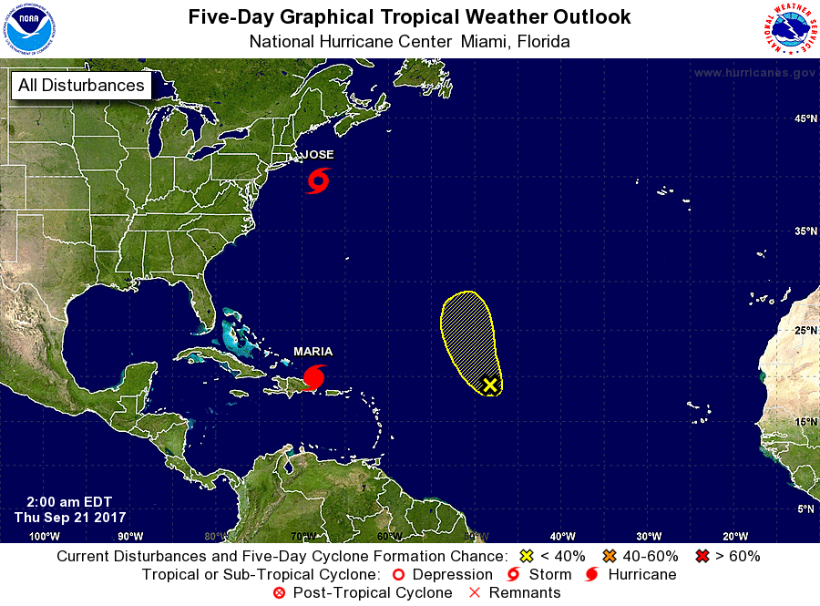
Tropical Weather Outlook
NWS National Hurricane Center Miami FL
200 AM EDT Thu Sep 21 2017
For the North Atlantic...Caribbean Sea and the Gulf of Mexico:
The National Hurricane Center is issuing advisories on Tropical
Storm Jose, located a couple of hundred miles southeast of
Nantucket, Massachusetts, and on Hurricane Maria, located less than
one hundred miles northeast of Punta Cana, Dominican Republic.
1. Shower and thunderstorm activity associated with the remnants
of Lee remain very limited. Upper-level winds are expected
to remain unfavorable for significant development during the next
several days. The low is forecast to move north-northwestward or
northward over the open waters of the central Atlantic Ocean.
* Formation chance through 48 hours...low...10 percent.
* Formation chance through 5 days...low...10 percent.
Forecaster Pasch