ZCZC MIATWOAT ALL
TTAA00 KNHC DDHHMM
Tropical Weather Outlook
NWS National Hurricane Center Miami FL
800 PM EDT Wed Sep 13 2017
For the North Atlantic...Caribbean Sea and the Gulf of Mexico:
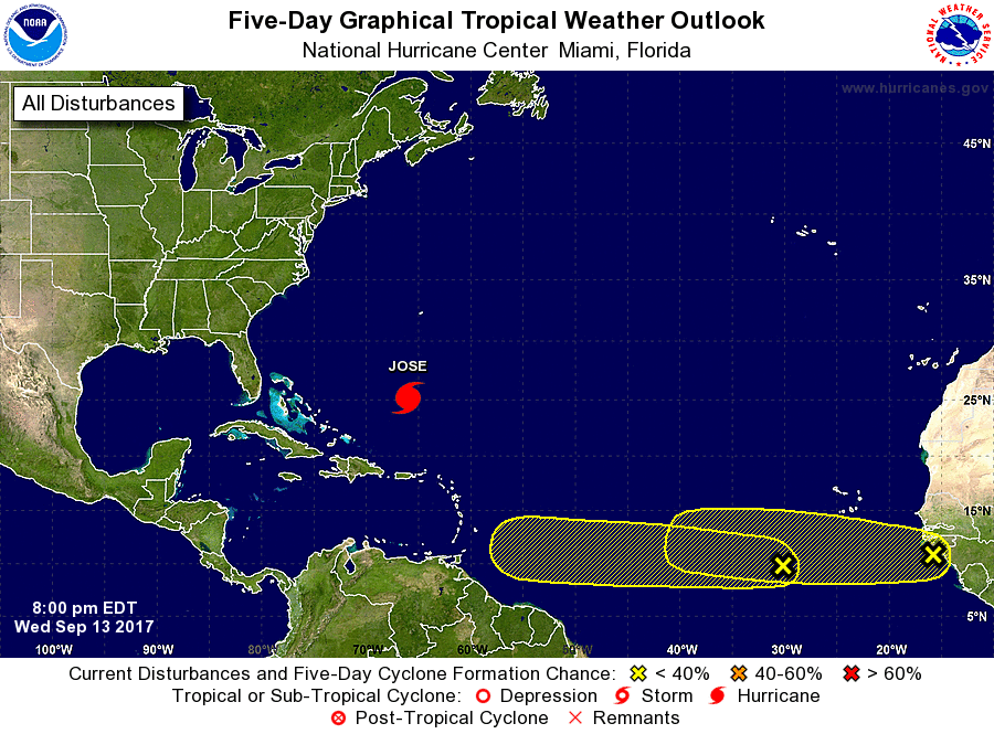
The National Hurricane Center is issuing advisories on Hurricane
Jose, located several hundred miles east-northeast of the
southeastern Bahamas.
1. A tropical wave located about 600 miles southwest of the Cabo Verde
Islands is producing disorganized shower and thunderstorm activity.
Some gradual development of this system is possible over the next
several days while it moves westward at around 15 mph across the
tropical Atlantic.
* Formation chance through 48 hours...low...10 percent.
* Formation chance through 5 days...low...30 percent.
2. A large area of disturbed weather located near the west coast of
Africa is producing disorganized shower and thunderstorm activity.
Some gradual development of this system is possible over the next
several days while it moves westward at 10 to 15 mph across the far
eastern tropical Atlantic.
* Formation chance through 48 hours...low...10 percent.
* Formation chance through 5 days...low...20 percent.
Forecaster Brennan