ZCZC MIATWOAT ALL
TTAA00 KNHC DDHHMM
Tropical Weather Outlook
NWS National Hurricane Center Miami FL
800 PM EDT Sat Sep 2 2017
For the North Atlantic...Caribbean Sea and the Gulf of Mexico:
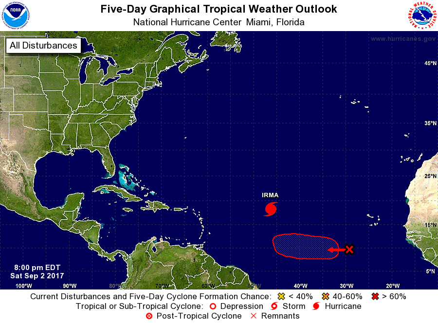
The National Hurricane Center is issuing advisories on Hurricane
Irma, located over the central tropical Atlantic Ocean.
1. A large but disorganized area of showers and thunderstorms located
a few hundred miles southwest of the Cabo Verde Islands is
associated with a tropical wave. Environmental conditions are
expected to become more favorable for development, and a tropical
depression is likely to form by the middle of next week while the
disturbance moves westward at 10 to 15 mph over the tropical
Atlantic.
* Formation chance through 48 hours...low...near 0 percent.
* Formation chance through 5 days...high...70 percent.
Forecaster Avila