ZCZC MIATWOAT ALL
TTAA00 KNHC DDHHMM
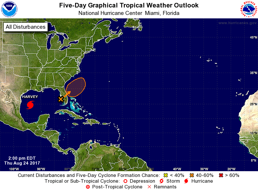
Tropical Weather Outlook
NWS National Hurricane Center Miami FL
200 PM EDT Thu Aug 24 2017
For the North Atlantic...Caribbean Sea and the Gulf of Mexico:
The National Hurricane Center is issuing advisories on recently
upgraded Hurricane Harvey, located over the southwestern Gulf of
Mexico.
1. A trough of low pressure near the Florida peninsula continues to
produce disorganized showers and thunderstorms extending across the
Bahamas, southern and central Florida, and the adjacent waters.
Development, if any, of this system should be slow to occur while it
drifts northward to northeastward during the next day or two. Some
tropical or subtropical development is possible over the weekend or
early next week while the system moves northeastward over the
western Atlantic before it merges with a front. Regardless of
development, very heavy rain and flooding is possible over portions
of the Florida peninsula during the next few days. Please refer to
products from your local National Weather Service office for more
information on this system.
* Formation chance through 48 hours...low...10 percent.
* Formation chance through 5 days...medium...40 percent.
Forecaster Pasch