ZCZC MIATWOAT ALL
TTAA00 KNHC DDHHMM
Tropical Weather Outlook
NWS National Hurricane Center Miami FL
800 AM EDT Mon Aug 7 2017
For the North Atlantic...Caribbean Sea and the Gulf of Mexico:
The National Hurricane Center is issuing advisories on Tropical
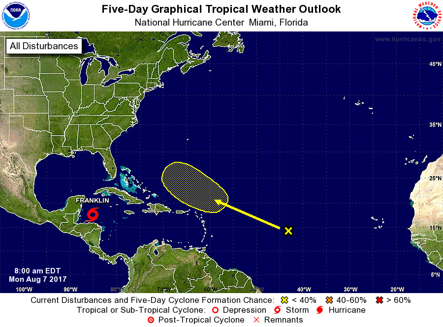
Storm Franklin, located a couple of hundred miles east of Belize.
1. An elongated area of low pressure located about midway between the
Cabo Verde Islands and the Lesser Antilles is producing disorganized
shower and thunderstorm activity. Unfavorable environmental
conditions should limit development of this system during the next
few days, but conditions could become more conducive for some
increase in organization of this disturbance by the end of the week.
This system is expected to move generally west-northwestward across
the tropical Atlantic at about 15 mph during the next several days.
* Formation chance through 48 hours...low...near 0 percent.
* Formation chance through 5 days...low...20 percent.
Public Advisories on Franklin are issued under WMO header
WTNT32 KNHC and under AWIPS header MIATCPAT2.
Forecast/Advisories on Franklin are issued under WMO header
WTNT22 KNHC and under AWIPS header MIATCMAT2.
Forecaster Cangialosi