ZCZC MIATWOAT ALL
TTAA00 KNHC DDHHMM
TROPICAL WEATHER OUTLOOK
NWS NATIONAL HURRICANE CENTER MIAMI FL
200 AM EDT THU OCT 20 2016
For the North Atlantic...Caribbean Sea and the Gulf of Mexico:
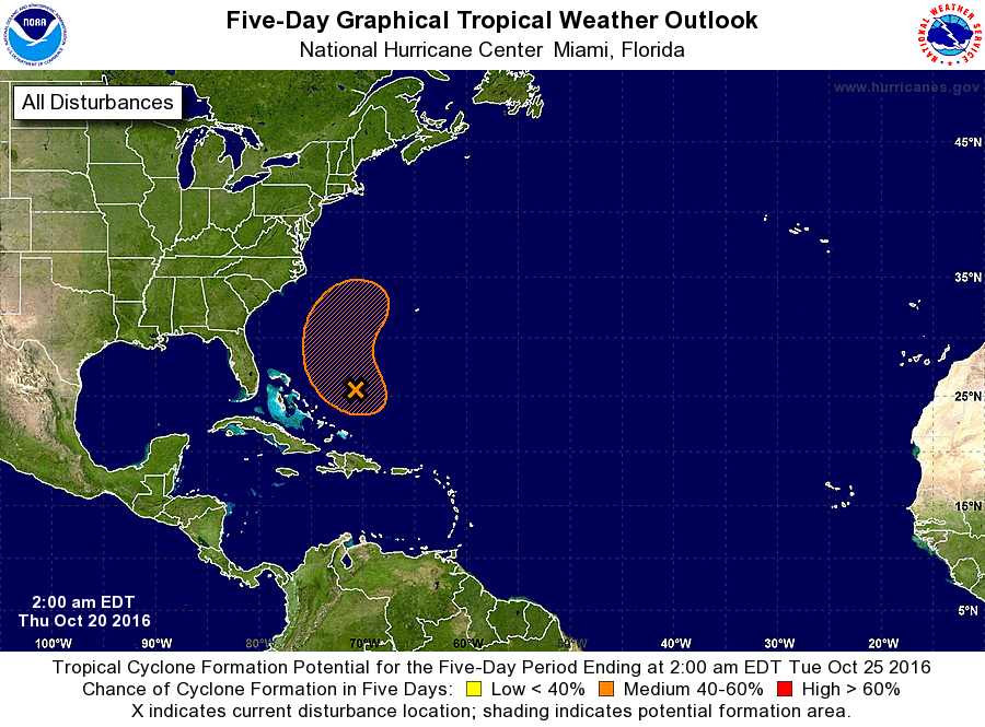
1. An elongated area of low pressure located about 300 miles
east-northeast of the Central Bahamas is moving northwestward
at about 10 mph. Although the associated shower and thunderstorm
activity remains disorganized, environmental conditions could become
a little more conducive for the low to acquire some tropical
characteristics during the next day or so, and this system could
still become a subtropical or tropical cyclone before it merges with
a cold front over the western Atlantic late Friday. A NOAA
reconnaissance aircraft is scheduled to investigate this system
this afternoon, if necessary. Regardless of development, locally
heavy rainfall is possible over Hispaniola and Puerto Rico today.
* Formation chance through 48 hours...medium...50 percent
* Formation chance through 5 days...medium...50 percent
Forecaster Brown