ZCZC MIATWOAT ALL
TTAA00 KNHC DDHHMM
TROPICAL WEATHER OUTLOOK
NWS NATIONAL HURRICANE CENTER MIAMI FL
800 AM EDT TUE OCT 18 2016
For the North Atlantic...Caribbean Sea and the Gulf of Mexico:
The National Hurricane Center has issued the last advisory on
Post-Tropical Cyclone Nicole, located several hundred miles
east-southeast of Cape Race, Newfoundland.
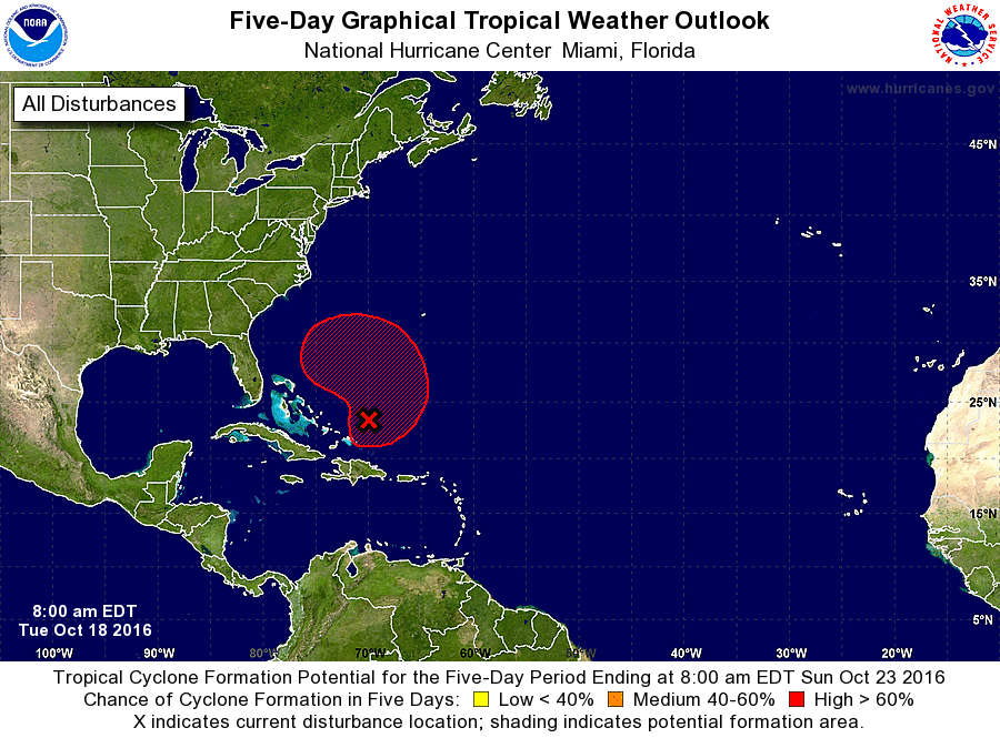
1. Shower activity associated with a well-defined, non-tropical low
pressure system located just to the northeast of the Turks and
Caicos has changed little during the past several hours. The low is
expected to slowly intensify as upper-level winds become more
conducive, and a subtropical or tropical cyclone could form during
the next couple of days while the low moves northward on Wednesday
and turns north-northwestward or northwestward on Thursday.
* Formation chance through 48 hours...medium...40 percent
* Formation chance through 5 days...high...70 percent
Additional information on Post-Tropical Cyclone Nicole can be found
in High Seas Forecasts issued by the National Weather Service, under
AWIPS header NFDHSFAT1, WMO header FZNT01 KWBC, and available on the
Web at http://www.opc.ncep.noaa.gov/shtml/NFDHSFAT1.shtml.
Forecaster Stewart