ZCZC MIATWOAT ALL
TTAA00 KNHC DDHHMM
TROPICAL WEATHER OUTLOOK
NWS NATIONAL HURRICANE CENTER MIAMI FL
200 PM EDT SUN OCT 16 2016
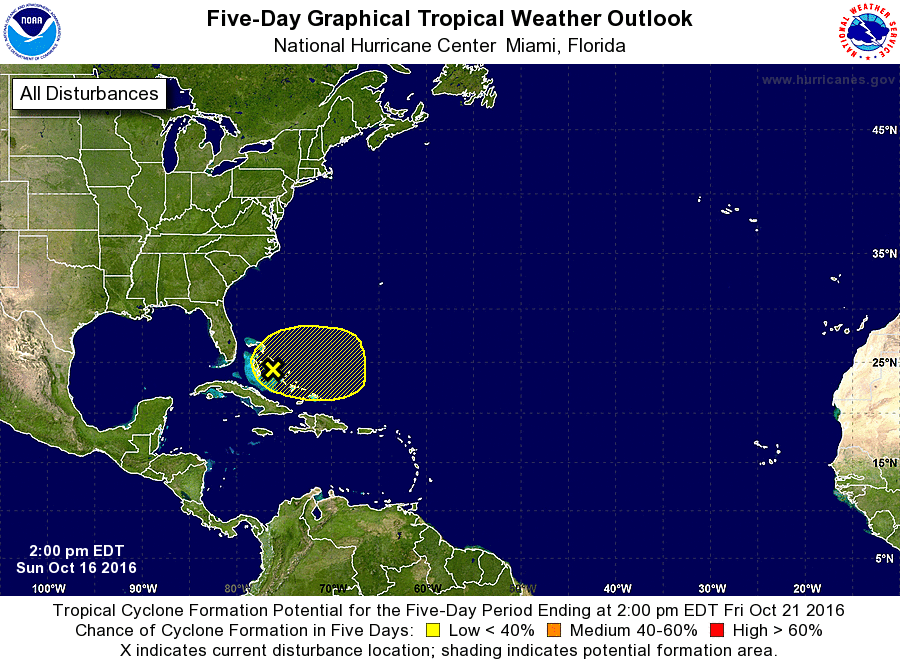
For the North Atlantic...Caribbean Sea and the Gulf of Mexico:
1. A surface trough interacting with an upper-level low continues to
produce a large area of cloudiness and disorganized showers and
thunderstorms over most of the Bahamas and adjacent waters of the
western Atlantic and the Florida Straits. Environmental conditions
are currently unfavorable for any significant development to occur,
but they could become more conducive by Tuesday or Wednesday while
the system drifts eastward. Regardless of development, locally
heavy rainfall will be possible over the Bahamas during the next
couple of days.
* Formation chance through 48 hours...low...20 percent
* Formation chance through 5 days...low...30 percent
Forecaster Stewart