ZCZC MIATWOAT ALL
TTAA00 KNHC DDHHMM
TROPICAL WEATHER OUTLOOK
NWS NATIONAL HURRICANE CENTER MIAMI FL
800 PM EDT TUE SEP 6 2016
For the North Atlantic...Caribbean Sea and the Gulf of Mexico:
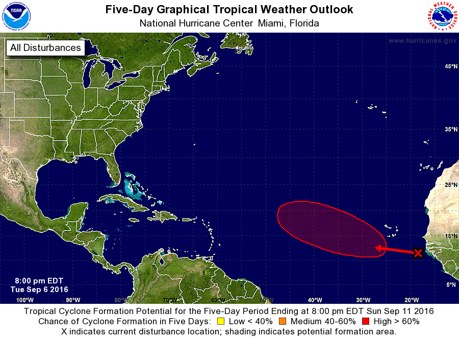
1. A tropical wave located over the far eastern Atlantic Ocean just
west of the coast of Africa is producing disorganized showers and a
few thunderstorms. A low pressure area is expected to form in
association with the wave several hundred miles west-southwest
of the Cabo Verde Islands in a couple of days. Environmental
conditions are expected to be conducive for gradual development,
and a tropical depression could form by the weekend while the
system moves west-northwestward to northwestward toward the
central tropical Atlantic.
* Formation chance through 48 hours...low...20 percent
* Formation chance through 5 days...high...70 percent
Forecaster Brown