ZCZC MIATWOAT ALL
TTAA00 KNHC DDHHMM
TROPICAL WEATHER OUTLOOK
NWS NATIONAL HURRICANE CENTER MIAMI FL
200 PM EDT SAT AUG 6 2016
For the North Atlantic...Caribbean Sea and the Gulf of Mexico:
The National Hurricane Center has issued the last advisory on
Earl, which dissipated well inland near Mexico City.
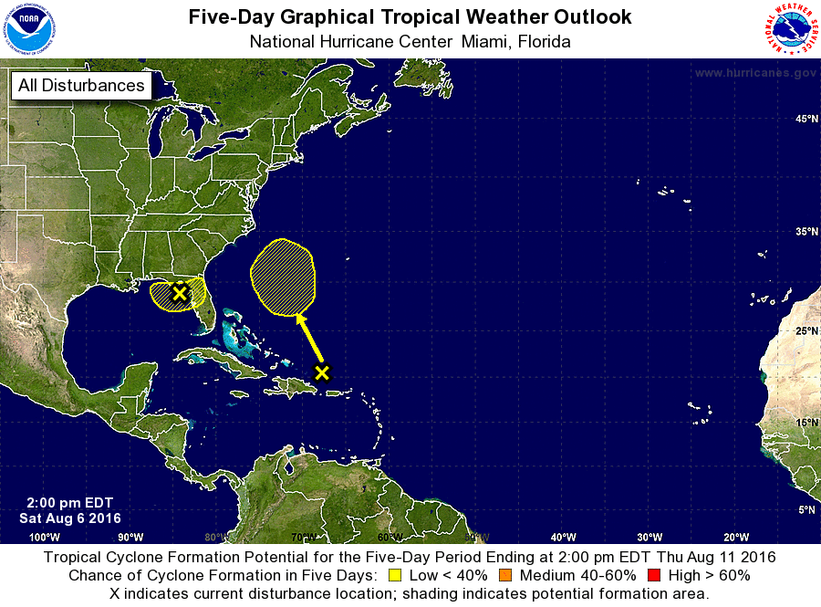
1. An area of cloudiness and thunderstorms associated with a trough of
low pressure is located over the northeastern Gulf of Mexico. Some
slight development is possible before the system moves inland over
the southeastern United States in a couple of days. Regardless of
development, heavy rainfall over northern Florida is anticipated.
* Formation chance through 48 hours...low...20 percent
* Formation chance through 5 days...low...20 percent
2. A tropical wave is producing disorganized cloudiness and showers
just north of Puerto Rico and the adjacent Atlantic. This activity
is expected to move northwestward and northward, and an area of
low pressure could form in the Atlantic by the middle of next week
between Florida and Bermuda.
* Formation chance through 48 hours...low...near 0 percent
* Formation chance through 5 days...low...20 percent
Forecaster Avila