Skip Navigation Links
NOAA NOAA United States Department of Commerce

NHC Graphical Outlook Archive


« Earliest Available         ‹ Earlier         Later ›         Latest Available »
GIS Shapefiles
tab Eastern North Pacific tab tab Atlantic tab

View 2-Day Graphical Tropical Weather Outlook
Click for Eastern North Pacific Click for Eastern North Pacific

Tropical Weather Outlook Text

ZCZC MIATWOAT ALL
TTAA00 KNHC DDHHMM

TROPICAL WEATHER OUTLOOK
NWS NATIONAL HURRICANE CENTER MIAMI FL
800 PM EDT WED JUN 15 2016

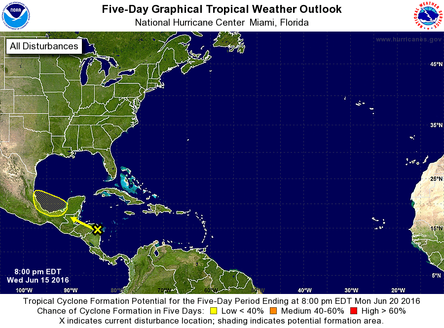
For the North Atlantic...Caribbean Sea and the Gulf of Mexico:

1. A tropical wave located over eastern Honduras, eastern Nicaragua,
and the adjacent waters of the western Caribbean Sea is producing
a broad area of cloudiness and disorganized thunderstorm activity.
Development, if any, of this disturbance should be slow to occur due
to interaction with land while the system moves west-northwestward
at 10 to 15 mph toward the Bay of Campeche over the next few days.
* Formation chance through 48 hours...low...near 0 percent
* Formation chance through 5 days...low...10 percent

Forecaster Stewart


List of Atlantic Outlooks (May 2023 - present)
List of East Pacific Outlooks (May 2023 - present)
List of Central Pacific Outlooks (May 2023 - present)
List of Atlantic Outlooks (July 2014 - April 2023)
List of East Pacific Outlooks (July 2014 - April 2023)
List of Central Pacific Outlooks (June 2019 - April 2023)
List of Atlantic Outlooks (June 2009 - June 2014)
List of East Pacific Outlooks (June 2009 - June 2014)