


NHC Graphical Outlook Archive
|
« Earliest Available ‹ Earlier Later › Latest Available » |
GIS Shapefiles |
| Eastern North Pacific | Atlantic |
|
Tropical Weather Outlook Text
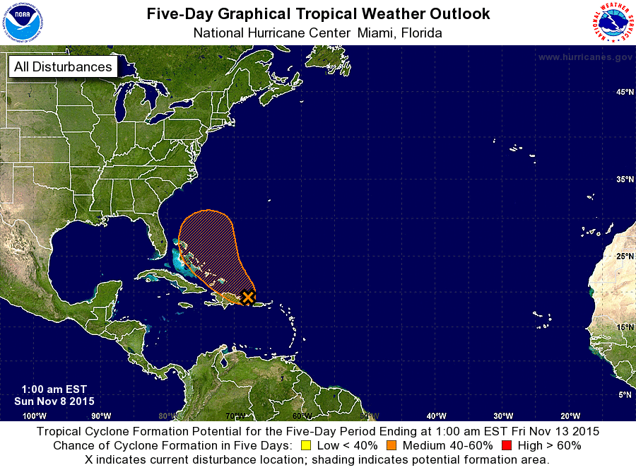
ZCZC MIATWOAT ALL
TTAA00 KNHC DDHHMM

TROPICAL WEATHER OUTLOOK
NWS NATIONAL HURRICANE CENTER MIAMI FL
100 AM EST SUN NOV 8 2015

For the North Atlantic...Caribbean Sea and the Gulf of Mexico:

1. An area of showers and thunderstorms extending northward from the
central Caribbean Sea across the Dominican Republic and the adjacent
Atlantic waters is associated with a surface trough.  Environmental
conditions are expected to be conducive for gradual development of
this disturbance during the next few days while it moves west-
northwestward, and then northwestward toward the southeastern and
central Bahamas.  Regardless of development, locally heavy rains are
possible over the Virgin Islands, Puerto Rico, Hispaniola, and the
southeastern Bahamas during the next few days.
* Formation chance through 48 hours...low...30 percent
* Formation chance through 5 days...medium...50 percent

Forecaster Brown
List of Atlantic Outlooks (May 2023 - present)
List of East Pacific Outlooks (May 2023 - present)
List of Central Pacific Outlooks (May 2023 - present)
List of Atlantic Outlooks (July 2014 - April 2023)
List of East Pacific Outlooks (July 2014 - April 2023)
List of Central Pacific Outlooks (June 2019 - April 2023)
List of Atlantic Outlooks (June 2009 - June 2014)
List of East Pacific Outlooks (June 2009 - June 2014)