


NHC Graphical Outlook Archive
|
« Earliest Available ‹ Earlier Later › Latest Available » |
GIS Shapefiles |
| Eastern North Pacific | Atlantic |
|
Tropical Weather Outlook Text
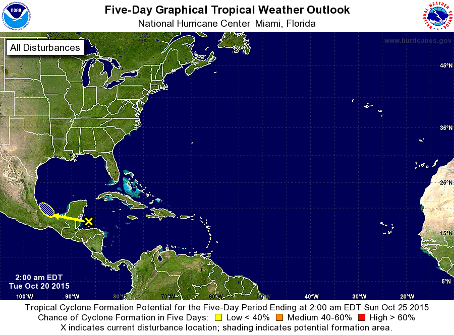
ZCZC MIATWOAT ALL
TTAA00 KNHC DDHHMM

TROPICAL WEATHER OUTLOOK
NWS NATIONAL HURRICANE CENTER MIAMI FL
200 AM EDT TUE OCT 20 2015

For the North Atlantic...Caribbean Sea and the Gulf of Mexico:

1. A weak area of low pressure located near the Gulf of Honduras is
producing disorganized shower and thunderstorm activity across
portions of the northwestern Caribbean Sea, the Yucatan Peninsula,
and Belize.  Although upper-level winds are marginally conducive for
tropical cyclone formation, land interaction is expected to inhibit
significant development while the disturbance moves slowly westward
to west-northwestward across the southern Yucatan Peninsula and into
the extreme southwestern Gulf of Mexico during the next few days.
Regardless of tropical cyclone formation, this system will likely
produce heavy rainfall across portions of Belize, northern
Guatemala, Honduras, and the Yucatan Peninsula during the next few
days.
* Formation chance through 48 hours...low...near 0 percent
* Formation chance through 5 days...low...10 percent

Forecaster Brown
List of Atlantic Outlooks (May 2023 - present)
List of East Pacific Outlooks (May 2023 - present)
List of Central Pacific Outlooks (May 2023 - present)
List of Atlantic Outlooks (July 2014 - April 2023)
List of East Pacific Outlooks (July 2014 - April 2023)
List of Central Pacific Outlooks (June 2019 - April 2023)
List of Atlantic Outlooks (June 2009 - June 2014)
List of East Pacific Outlooks (June 2009 - June 2014)