


NHC Graphical Outlook Archive
|
« Earliest Available ‹ Earlier Later › Latest Available » |
GIS Shapefiles |
| Eastern North Pacific | Atlantic |
|
Tropical Weather Outlook Text
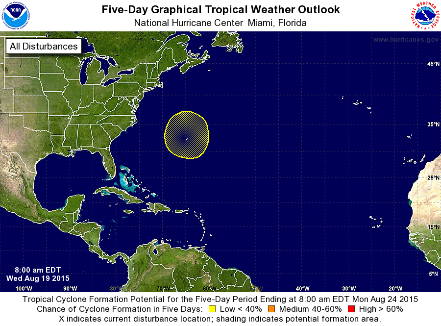
ZCZC MIATWOAT ALL
TTAA00 KNHC DDHHMM

TROPICAL WEATHER OUTLOOK
NWS NATIONAL HURRICANE CENTER MIAMI FL
800 AM EDT WED AUG 19 2015

For the North Atlantic...Caribbean Sea and the Gulf of Mexico:

The National Hurricane Center is issuing advisories on Tropical
Storm Danny, located over the central tropical Atlantic more than
1400 miles east of the Lesser Antilles.

1. A non-tropical area of low pressure could form within a couple of
hundred miles of Bermuda over the western Atlantic Ocean in a few
days.  Environmental conditions are expected to be marginally
favorable for some tropical or subtropical development of this
system by the weekend while it moves slowly northward.
* Formation chance through 48 hours...low...near 0 percent
* Formation chance through 5 days...low...30 percent

Public Advisories on Tropical Storm Danny are issued under WMO
header WTNT34 KNHC and under AWIPS header MIATCPAT4.
Forecast/Advisories on Tropical Storm Danny are issued under WMO
header WTNT24 KNHC and under AWIPS header MIATCMAT4.

Forecaster Stewart
List of Atlantic Outlooks (May 2023 - present)
List of East Pacific Outlooks (May 2023 - present)
List of Central Pacific Outlooks (May 2023 - present)
List of Atlantic Outlooks (July 2014 - April 2023)
List of East Pacific Outlooks (July 2014 - April 2023)
List of Central Pacific Outlooks (June 2019 - April 2023)
List of Atlantic Outlooks (June 2009 - June 2014)
List of East Pacific Outlooks (June 2009 - June 2014)