


NHC Graphical Outlook Archive
|
« Earliest Available ‹ Earlier Later › Latest Available » |
GIS Shapefiles |
| Eastern North Pacific | Atlantic |
|
Tropical Weather Outlook Text
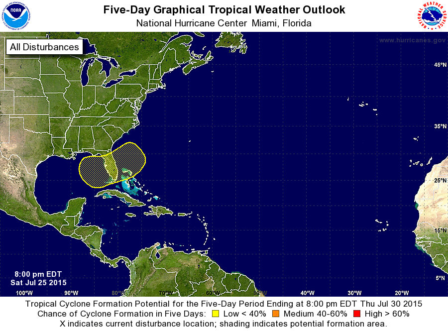
ZCZC MIATWOAT ALL
TTAA00 KNHC DDHHMM

TROPICAL WEATHER OUTLOOK
NWS NATIONAL HURRICANE CENTER MIAMI FL
800 PM EDT SAT JUL 25 2015

For the North Atlantic...Caribbean Sea and the Gulf of Mexico:

1. An elongated area of low pressure extending from the eastern Gulf
of Mexico eastward across the Florida peninsula and into the
adjacent Atlantic waters is producing disorganized cloudiness and
thunderstorms.  Upper-level winds are not favorable for tropical
or subtropical cyclone formation, and development, if any, will
be very slow to occur. Locally heavy rainfall can be expected across
portions of the Florida peninsula through the weekend and into early
next week.
* Formation chance through 48 hours...low...near 0 percent
* Formation chance through 5 days...low...10 percent

Forecaster Avila
List of Atlantic Outlooks (May 2023 - present)
List of East Pacific Outlooks (May 2023 - present)
List of Central Pacific Outlooks (May 2023 - present)
List of Atlantic Outlooks (July 2014 - April 2023)
List of East Pacific Outlooks (July 2014 - April 2023)
List of Central Pacific Outlooks (June 2019 - April 2023)
List of Atlantic Outlooks (June 2009 - June 2014)
List of East Pacific Outlooks (June 2009 - June 2014)