


NHC Graphical Outlook Archive
|
« Earliest Available ‹ Earlier Later › Latest Available » |
GIS Shapefiles |
| Eastern Pacific | Atlantic |
|
Tropical Weather Outlook Text
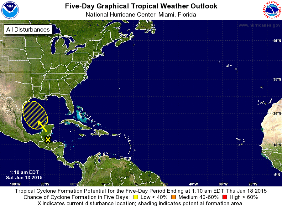
ZCZC MIATWOAT ALL
TTAA00 KNHC DDHHMM

SPECIAL TROPICAL WEATHER OUTLOOK
NWS NATIONAL HURRICANE CENTER MIAMI FL
110 AM EDT SAT JUN 13 2015

For the North Atlantic...Caribbean Sea and the Gulf of Mexico:

1. Disorganized showers and thunderstorms extending from Central
America northward across the northwestern Caribbean Sea are
primarily associated with an upper-level trough.  This activity is
expected to spread into the southwestern Gulf of Mexico on Sunday.
Upper-level winds are only marginal for tropical cyclone formation
and development, if any, will be slow to occur while this system
moves generally northwestward through the middle of next week.
* Formation chance through 48 hours...low...10 percent
* Formation chance through 5 days...low...20 percent

Forecaster Avila
List of Atlantic Outlooks (May 2023 - present)
List of East Pacific Outlooks (May 2023 - present)
List of Central Pacific Outlooks (May 2023 - present)
List of Atlantic Outlooks (July 2014 - April 2023)
List of East Pacific Outlooks (July 2014 - April 2023)
List of Central Pacific Outlooks (June 2019 - April 2023)
List of Atlantic Outlooks (June 2009 - June 2014)
List of East Pacific Outlooks (June 2009 - June 2014)