


NHC Graphical Outlook Archive
|
« Earliest Available ‹ Earlier Later › Latest Available » |
| Eastern Pacific | Atlantic |
|
|
(mouse over shaded areas for details; click on shaded areas or disturbance numbers to switch views) |
Tropical Weather Outlook Text
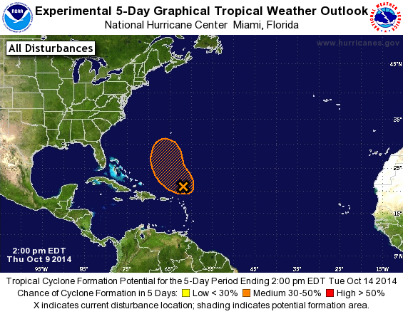
TROPICAL WEATHER OUTLOOK
NWS NATIONAL HURRICANE CENTER MIAMI FL
200 PM EDT THU OCT 9 2014

For the North Atlantic...Caribbean Sea and the Gulf of Mexico:

1. Shower and thunderstorm activity, associated with a broad surface
low pressure area and an upper-level low, is becoming a little
better organized several hundred miles northeast of the northern
Leeward Islands.  Environmental conditions appear generally
conducive for additional development during the next couple of days,
and a tropical or subtropical depression could form by the weekend
while the system moves northwestward or north-northwestward at about
10 mph.
* Formation chance through 48 hours...medium...50 percent.
* Formation chance through 5 days...medium...50 percent.

Forecaster Berg
List of Atlantic Outlooks (May 2023 - present)
List of East Pacific Outlooks (May 2023 - present)
List of Central Pacific Outlooks (May 2023 - present)
List of Atlantic Outlooks (July 2014 - April 2023)
List of East Pacific Outlooks (July 2014 - April 2023)
List of Central Pacific Outlooks (June 2019 - April 2023)
List of Atlantic Outlooks (June 2009 - June 2014)
List of East Pacific Outlooks (June 2009 - June 2014)