


NHC Graphical Outlook Archive
|
« Earliest Available ‹ Earlier Later › Latest Available » |
| Eastern Pacific | Atlantic |
|
|
(mouse over shaded areas for details; click on shaded areas or disturbance numbers to switch views) |
Tropical Weather Outlook Text
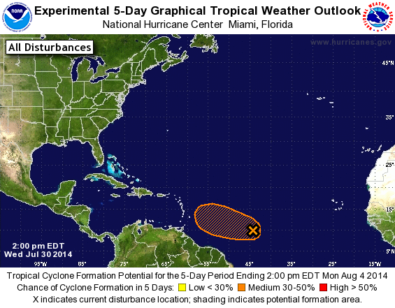
TROPICAL WEATHER OUTLOOK
NWS NATIONAL HURRICANE CENTER MIAMI FL
200 PM EDT WED JUL 30 2014

For the North Atlantic...Caribbean Sea and the Gulf of Mexico:

1. Showers and thunderstorms associated with an area of low pressure
located about 1000 miles east of the southern Windward Islands have
been gradually decreasing since yesterday.  However, environmental
conditions are marginally conducive for the development of this
system into a tropical depression during the next couple of days.
Interests in the Lesser Antilles should monitor the progress of this
system as it moves west-northwestward near 15 mph.
* Formation chance through 48 hours...medium...50 percent.
* Formation chance through 5 days...medium...50 percent.

Forecaster Pasch
List of Atlantic Outlooks (May 2023 - present)
List of East Pacific Outlooks (May 2023 - present)
List of Central Pacific Outlooks (May 2023 - present)
List of Atlantic Outlooks (July 2014 - April 2023)
List of East Pacific Outlooks (July 2014 - April 2023)
List of Central Pacific Outlooks (June 2019 - April 2023)
List of Atlantic Outlooks (June 2009 - June 2014)
List of East Pacific Outlooks (June 2009 - June 2014)