ZCZC MIATWOAT ALL
TTAA00 KNHC DDHHMM

Tropical Weather Outlook
NWS National Hurricane Center Miami FL
700 PM EST Fri Nov 24 2023

For the North Atlantic...Caribbean Sea and the Gulf of Mexico:

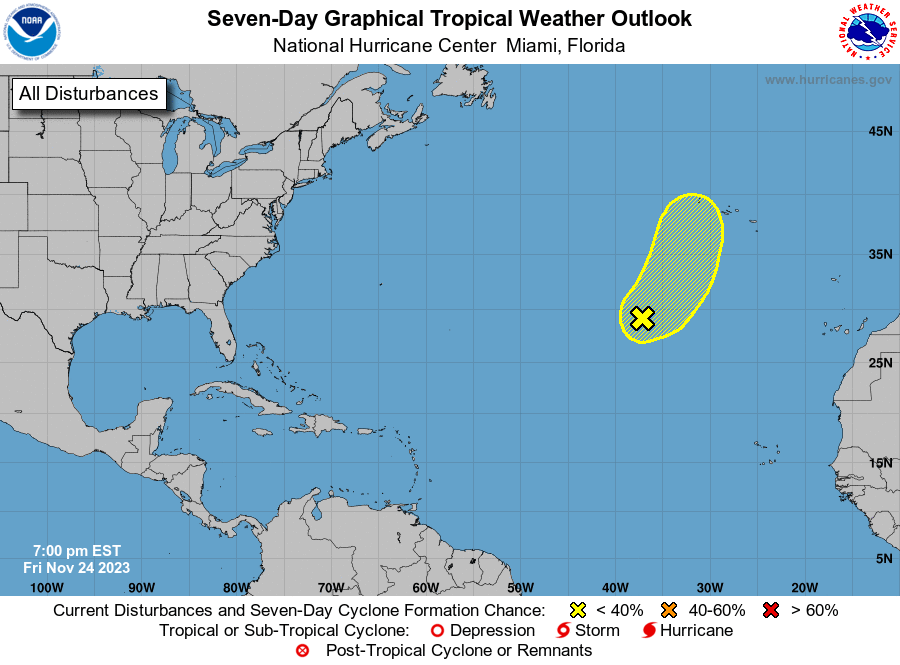
1. Central Subtropical Atlantic (AL90):
Shower and thunderstorm activity has not yet become better organized
with a non-tropical area of low pressure located over the central
subtropical Atlantic. There is still a chance the system could
acquire some subtropical or tropical characteristics during the next
day or so as it continues moves northeastward. Thereafter, the low
will begin moving over much colder waters, likely ending its chances
of subtropical or tropical development by early next week.
* Formation chance through 48 hours...low...20 percent.
* Formation chance through 7 days...low...20 percent.

Forecaster Papin





 NHC on Facebook
 Twitter
 YouTube
 NHC Blog: