ZCZC MIATWOAT ALL
TTAA00 KNHC DDHHMM
Tropical Weather Outlook
NWS National Hurricane Center Miami FL
200 PM EDT Fri Oct 20 2023
For the North Atlantic...Caribbean Sea and the Gulf of Mexico:
Active Systems:
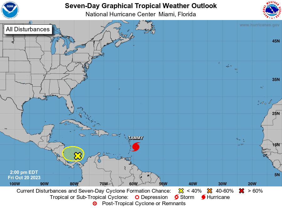
The National Hurricane Center is issuing advisories on Hurricane
Tammy, located about 150 miles east-southeast of the Leeward
Islands.
1. Southwestern Caribbean Sea:
Disorganized showers and thunderstorms over the far southwestern
Caribbean Sea are associated with a broad area of low pressure. Some
slow development of this system is possible this weekend and early
next week while it moves slowly westward over the southwestern
Caribbean Sea. The disturbance is forecast to move inland over
Central America late Monday or Tuesday, and no further development
is expected after that time.
* Formation chance through 48 hours...low...10 percent.
* Formation chance through 7 days...low...20 percent.
Forecaster Brown