ZCZC MIATWOAT ALL
TTAA00 KNHC DDHHMM
Tropical Weather Outlook
NWS National Hurricane Center Miami FL
800 AM EDT Sat Oct 14 2023
For the North Atlantic...Caribbean Sea and the Gulf of Mexico:
Active Systems:
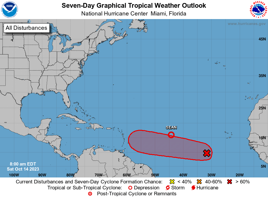
The National Hurricane Center is issuing advisories on Tropical
Storm Sean, located over the central tropical Atlantic.
1. Eastern Tropical Atlantic (AL94):
Showers and thunderstorms associated with an area of low pressure
located several hundred miles southwest of the Cabo Verde Islands
have become more concentrated, and better organized during the past
several hours. Environmental conditions are becoming more conducive
for further development, and a tropical depression is likely to form
within the next couple of days while the system moves westward or
west-northwestward across the central and western tropical Atlantic.
* Formation chance through 48 hours...high...70 percent.
* Formation chance through 7 days...high...90 percent.
Forecaster Kelly