ZCZC HFOTWOCP ALL
TTAA00 PHFO DDHHMM
Tropical Weather Outlook
NWS Central Pacific Hurricane Center Honolulu HI
200 PM HST Tue Aug 29 2023
For the central North Pacific...between 140W and 180W:
Active Systems:
The National Hurricane Center in Miami, Florida has issued the last
advisory on Post-Tropical Cyclone Irwin, centered around 1600
miles east of Hilo, Hawaii. Atmospheric conditions are not
conducive for redevelopment into a tropical cyclone as the low
moves west at 15 mph. The low is expected to move into the Central
Pacific Hurricane Center area of responsibility on Friday.
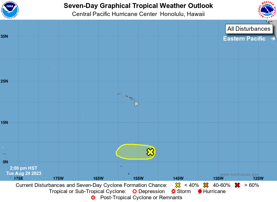
1. Approximately 750 miles south-southeast of Hilo, Hawaii (CP90):
Shower activity continues to diminish in association with a broad
area of low pressure. This system is moving west-southwestward at
10 to 15 mph into unfavorable environmental conditions and
tropical cyclone formation is becoming less likely.
* Formation chance through 48 hours...low...10 percent.
* Formation chance through 7 days...low...10 percent.
Elsewhere, no tropical cyclones are expected during the next 7 days.
Forecaster Shigesato