ZCZC MIATWOAT ALL
TTAA00 KNHC DDHHMM
Tropical Weather Outlook
NWS National Hurricane Center Miami FL
800 PM EDT Sun Aug 13 2023
For the North Atlantic...Caribbean Sea and the Gulf of Mexico:
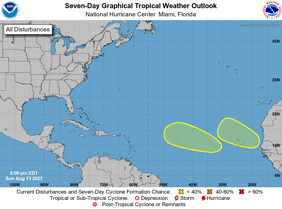
1. Eastern Tropical Atlantic:
An area of low pressure is forecast to develop in a few days over
the far eastern Atlantic between the Cabo Verde Islands and the west
coast of Africa. Some slow development of this system is possible
later this week as it moves slowly west-northwestward or
northwestward across the eastern Atlantic.
* Formation chance through 48 hours...low...near 0 percent.
* Formation chance through 7 days...low...20 percent.
2. Central Tropical Atlantic:
Another area of low pressure could develop by the middle to latter
portion of this week over the east-central tropical Atlantic
several hundred miles southwest of the Cabo Verde Islands.
Some slow development of this system is also possible as it moves
west-northwestward over the central tropical Atlantic.
* Formation chance through 48 hours...low...near 0 percent.
* Formation chance through 7 days...low...20 percent.
Forecaster Papin