ZCZC MIATWOAT ALL
TTAA00 KNHC DDHHMM

Tropical Weather Outlook
NWS National Hurricane Center Miami FL
200 AM EDT Wed Jul 26 2023

For the North Atlantic...Caribbean Sea and the Gulf of Mexico:

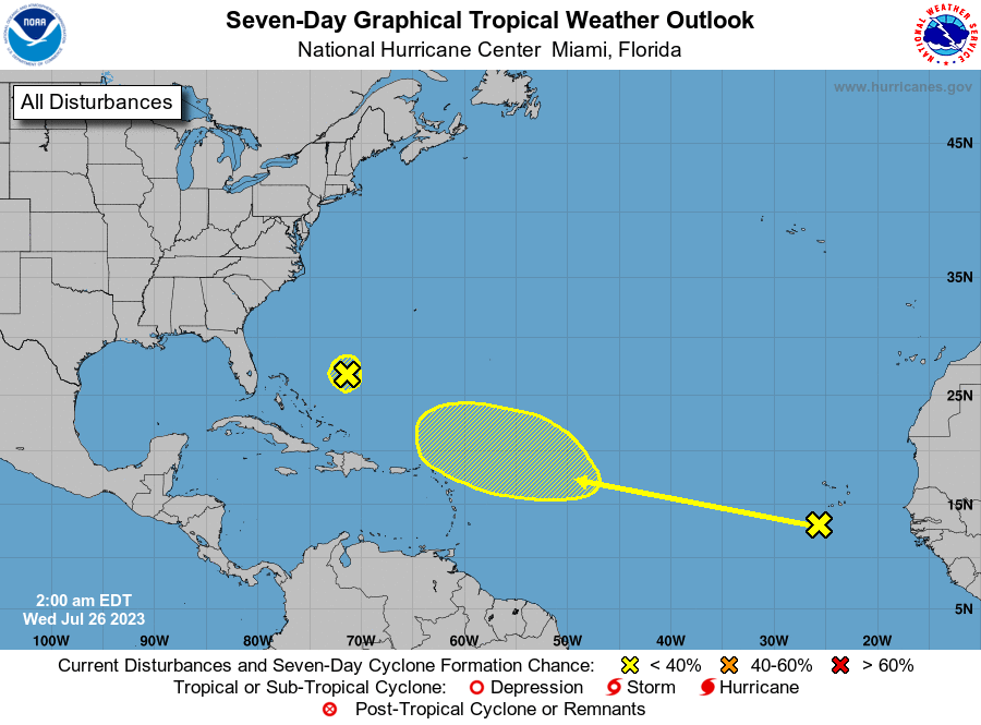
1. Southwestern Atlantic:
A weak trough of low pressure is located between Bermuda and the
Bahamas.  Development of this system is not anticipated while it
moves west-northwestward toward the southeastern U.S. coast over the
next several days.
* Formation chance through 48 hours...low...near 0 percent.
* Formation chance through 7 days...low...near 0 percent.

2. Eastern Atlantic:
A tropical wave is located south of the Cabo Verde Islands.  Some
development of this system is possible later this week and into the
weekend while it moves westward to west-northwestward over the
tropical Atlantic.
* Formation chance through 48 hours...low...near 0 percent.
* Formation chance through 7 days...low...30 percent.

Forecaster Beven





 NHC on Facebook
 Twitter
 YouTube
 NHC Blog: