ZCZC MIATWOAT ALL
TTAA00 KNHC DDHHMM
Tropical Weather Outlook
NWS National Hurricane Center Miami FL
200 AM EDT Tue Jun 27 2023
For the North Atlantic...Caribbean Sea and the Gulf of Mexico:
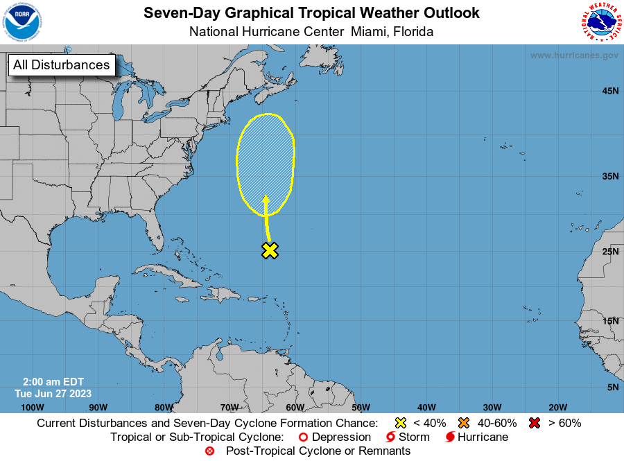
1. Southwestern Atlantic Ocean (Remnants of Cindy):
An area of low pressure, associated with the remnants of Cindy, is
producing disorganized showers and thunderstorms more than 400 miles
to the south-southeast of Bermuda. While strong upper-level winds
are expected to prevent redevelopment of this system over the next
couple of days, environmental conditions could become marginally
conducive for some gradual development during the latter part of
this week. The system is forecast to move generally northward over
the western Atlantic, passing near Bermuda on Thursday.
* Formation chance through 48 hours...low...near 0 percent.
* Formation chance through 7 days...low...30 percent.
Forecaster Kelly/Bucci